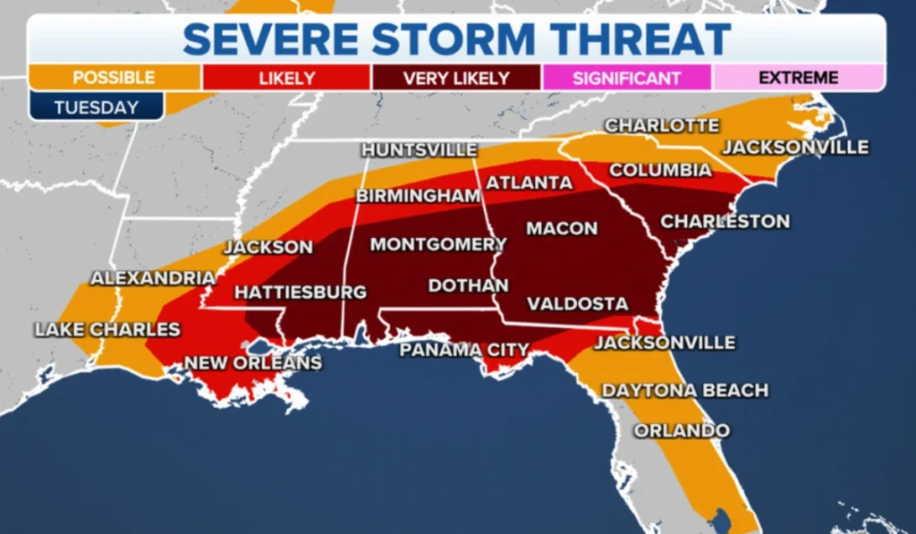
South Carolina faced an intense severe weather season in 2025, with the National Weather Service issuing repeated waves of thunderstorm and tornado warnings across dozens of counties throughout spring and summer.
On March 5, a powerful storm system moved through the Midlands early Wednesday morning, triggering tornado warnings for Calhoun, Chesterfield, Clarendon, Fairfield, Kershaw, Lancaster, Lee, Lexington, Orangeburg, Richland and Sumter counties. Between 7:18 a.m. and 9:22 a.m., multiple tornado warnings were issued and expired across different county combinations, with some areas cycling through several warnings within hours. The timing during morning commute hours created dangerous conditions for thousands of residents heading to work and school.
Later in March, on the 30th, the National Weather Service issued a severe thunderstorm watch until 9 p.m. for 16 South Carolina counties including Charleston, Berkeley, Dorchester, Colleton, Beaufort, Orangeburg, Jasper and Hampton. Wind gusts reached up to 60 mph, capable of damaging roofs, siding and trees, with meteorologists warning that travel on bridges could be dangerous for high-profile vehicles. This Lowcountry system struck during late afternoon and evening hours, catching people during their commute home.
The severe weather continued into summer. On July 14, severe thunderstorm warnings were issued for Southern Lancaster, Chesterfield, Kershaw, and Lee counties effective until 7:15 p.m., with wind gusts potentially reaching 60 mph and torrential rainfall raising concerns of localized flooding. In early June, another severe thunderstorm watch covered Charleston, Berkeley, Dorchester, Colleton, Williamsburg, Georgetown, Beaufort, Jasper, Hampton, Allendale, Dillon, Florence, Horry and Marion Counties, causing thousands of power outages and multiple reports of downed trees and limbs across the affected areas.
Additional severe weather struck in early March when a line of strong storms pushed eastward into the Charlotte region, with several counties in both Carolinas covered by severe thunderstorm warnings and two tornado warnings issued—one in Union County, North Carolina, and another in Chester County, South Carolina. Heavy rain, damaging winds and tornadoes were possible as the system moved through, with winds gusting up to 40-50 mph even outside the severe thunderstorms, potentially causing trees to fall and power outages.
The repeated multi-county alerts throughout 2025 created significant challenges for emergency management, with residents across the Upstate, Midlands, Lowcountry, and Pee Dee regions all experiencing multiple severe weather events. The cumulative impact included widespread power outages, property damage from fallen trees, and the constant need for residents to seek shelter and prepare for dangerous conditions. This pattern of intense, frequent severe weather established 2025 as an exceptionally active storm season for South Carolina, requiring sustained vigilance from residents and emergency services across the state.


